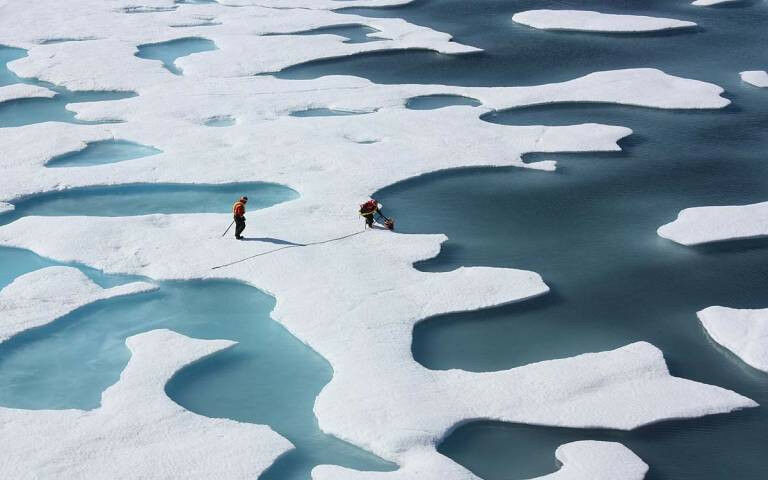
ponds on ice floes
ponds on ice floes - Satellites can now measure the thickness of Arctic sea ice in the summer months for the first time, thanks to a new study involving UCL researchers. Until now, satellites could only measure sea ice thickness between October and March, when the ice and snow are cold and dry. In the warmer months, melt ponds on top of the ice floes confused the instruments, which could not be used to distinguish between melted ice on an ice floe and the ocean. In the new study, published in the journal Nature , researchers used an artificial intelligence technique to correct this problem, in which an algorithm was trained on thousands of simulations of satellite data to reliably distinguish between melt ponds and the ocean. The team have now developed the first dataset showing the thickness of sea ice across the entire Arctic and through a whole year. The dataset represents a key step forwards for measuring sea ice thickness via satellite, an endeavour led by researchers at UCL over several decades. Dr Michel Tsamados (UCL Earth Sciences), a co-author of the study, said: "The thickness of Arctic sea ice is a critically important measure, for the health of the Arctic, for our future climate, and for life on Earth.
TO READ THIS ARTICLE, CREATE YOUR ACCOUNT
And extend your reading, free of charge and with no commitment.