 Smapshot lets users position archival photos over a virtual map of contemporary Switzerland.
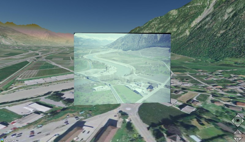
A crowdmapping project developed by EPFL and HEIG-VD gives volunteers the chance to compare the Switzerland of the 1960s with that of today through archival photos. An exhibition organized by EPFL's Modern Construction Archives will show the research implications of these historical photos. Launched just six weeks ago, Smapshot is a public web portal on which anyone can geotag aerial photographs of Switzerland from the 1960s. They superimpose the provided photos onto a virtual map of contemporary Switzerland that was built from data provided by the Federal Office of Topography (Swisstopo). Users can then add anecdotes about the location, provide additional topographical information, chat with other users and share their discoveries on Facebook. And as thanks for their help, they are allowed to print the archival photo that they geotagged. The crowdmapping project, a joint initiative of EPFL and HEIG-VD (the Vaud School of Management and Engineering), could lead to some interesting applications in research, urban development and augmented reality.
TO READ THIS ARTICLE, CREATE YOUR ACCOUNT
And extend your reading, free of charge and with no commitment.
Your Benefits
- Access to all content
- Receive newsmails for news and jobs
- Post ads