jason-cs-2
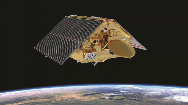
jason-cs-2 - More precise information about global sea level than has ever been available before - critical for monitoring climate change - comes on-stream today with the completion of 12 months of intensive, in-orbit testing of the Copernicus Sentinel-6 Michael Freilich satellite. This unique, European-American mission will shortly become the reference mission, against which all other satellite ocean altimetry missions will measure their accuracy. Today's first release of high-resolution data from the satellite's altimeter comes just weeks after the COP26 meeting in Glasgow heard more about the growing threat posed to coastal communities and island states from rising sea levels due to climate change. "The data released today is critical for monitoring the impact of climate change on Earth's oceans," EUMETSAT Ocean Altimetry Programme Manager Julia Figa Saldana said. "As the satellite ocean altimetry reference mission, it will continue the unbroken high-precision data record of sea level rise first started in 1992. "Experts from around the globe have closely examined and validated the data, confirming that the Copernicus Sentinel-6 Michael Freilich mission is robust, precise and highly reliable. "By cross-calibrating Sentinel-6 against its predecessor Jason-3 to within 1mm, we ensure that the 30-year long record of global mean sea level, as captured by satellite radar altimeters, continues uninterrupted." Copernicus Sentinel-6 Michael Freilich is controlled from EUMETSAT's Darmstadt headquarters, where its altimetry data is processed then disseminated to users of the data.
TO READ THIS ARTICLE, CREATE YOUR ACCOUNT
And extend your reading, free of charge and with no commitment.