Copyright
contains modified Copernicus Sentinel data (2018), processed by EUMETSAT,
CC BY-SA 3.0 IGO
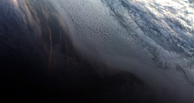
The Copernicus Sentinel-3B satellite captured its first image on 7 May 2018 at 10:33 GMT (12:33 CEST), less than two weeks after it was launched. The image shows the sunset over the Weddell Sea off the coast of Antarctica. While the line between day and night is clearly visible, bright streaks glint on the clouds from the sunset. The image was taken by the satellite's ocean and land colour instrument, which features 21 distinct bands, a resolution of 300 m and a swath width of 1270 km. The instrument can be used to monitor aquatic biological productivity and marine pollution, and over land it can be used to monitor the health of vegetation. Sentinel-3B's instrument package also includes a sea and land surface temperature radiometer, a synthetic aperture radar altimeter and a microwave radiometer. Sentinel-3B was launched from Russia on 25 April and joins its twin, Sentinel-3A, in orbit.
TO READ THIS ARTICLE, CREATE YOUR ACCOUNT
And extend your reading, free of charge and with no commitment.