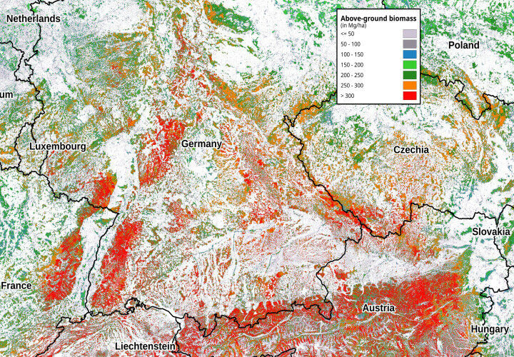
Example of a satellite image showing forest biomass distribution. Data collection in the forest is necessary for its creation. These images are to be optimised and used across Europe. Photo: Santoro, M.; Cartus, O. (2021): ESA Biomass Climate Change Initiative (Biomass_cci): Global datasets of forest above-ground biomass for the years 2010, 2017 and 2018, v3. NERC EDS Centre for Environmental Data Analysis, 26 November 2021.
Example of a satellite image showing forest biomass distribution. Data collection in the forest is necessary for its creation. These images are to be optimised and used across Europe. Photo: Santoro, M. Cartus, O. ESA Biomass Climate Change Initiative (Biomass_cci): Global datasets of forest above-ground biomass for the years 2010, 2017 and 2018, v3. NERC EDS Centre for Environmental Data Analysis, 26 November 2021. International team including Göttingen University develops forest inventories in "PathFinder" project Researchers from the University of Göttingen are involved in the project "PathFinder - Towards an Integrated Consistent European Land Use, Land-Use Change and Forestry Monitoring and Policy Pathway Assessment Framework". The European Commission has awarded six million euros funding for the project, as part of its Horizon Europe programme.
TO READ THIS ARTICLE, CREATE YOUR ACCOUNT
And extend your reading, free of charge and with no commitment.