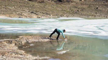
Glacier expert Willis named to Arctic mapping team
Michael Willis, Cornell earth and atmospheric sciences research associate, has been named to the ArcticDEM scientific team that will - for the first time - create high-resolution topographical Arctic maps. President Obama announced the project - funded by the National Science Foundation and the National Geospatial-Intelligence Agency - on his trip to Alaska Sept. 2. "This project will provide a state-of-the-art topography baseline against which future measurements of the Arctic can be compared. The Arctic will go from being one of the most poorly mapped regions on the planet to one of the most detailed, in one revolutionary step," said Willis. "The impact of this work has the potential to go beyond even the sort of large-regional investigations that we typically do. This new work is a large, collaborative effort that requires supercomputing facilities, access to very high-resolution satellite imagery, patience and vision." Composed of researchers from Cornell, the University of Minnesota-Twin Cities and Ohio State University, the ArcticDEM project, which stands for Arctic Digital Elevation Models and is funded for $420,000.