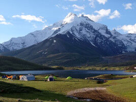
The Bavarian Danube Moss was once the largest fen in southern Germany. Since the late 18th century, the moss has been systematically drained and has since lost its natural character. A new interdisciplinary study led by the University of Leipzig now provides the first reconstruction of these profound changes over a period of 237 years and has been published in the renowned "E&G Quaternary Science Journal".
The results show two major phases of reconstruction and reveal Despite decades of existing restoration recommendations, no measurable progress can be seen so far. One possible explanation lies in the historically evolved socio-economic structures that could stand in the way of a sustainable transformation of the Danube moss.
As in many Central European wetlands, humans have been deliberately interfering with the water balance in the Donaumoos for centuries - with far-reaching ecological and landscape consequences. From 1788, the fens in northern Upper Bavaria were drained by a growing network of ditches and canals and gradually opened up for agricultural use. At the same time, the course of the adjacent Danube was straightened. The study that has now been published documents these interventions quantitatively for the first time over a period of more than two centuries.
The team of geographers, historians, ecologists and archaeologists analyzed historical maps from 1788 to 2023 as well as additional written sources. On this basis, the researchers were able to reconstruct how both the length of the drainage ditches in the Donaumoos and the water surface of the Danube have changed over the centuries.
Particularly striking interventions took place in two phases: The first phase of profound conversion began with the first cultivation measures from 1788 and lasted until around 1794, while the second phase spanned the period between 1907 and 1959. "The comparison of this quantitative data with knowledge from historical sources reveals when major upheavals in the history of the floodplain and moorland took place - and what consequences these had for the people in the region," explains Christoph Zielhofer, physical geographer at the University of Leipzig and head of the study. Marie Kaniecki, also a geographer at Leipzig University, describes how these processes were distributed over time: "These profound changes caused by river straightening, oil land reclamation and colonization did not occur continuously, but in waves - interrupted by decades of setbacks and stagnation.
No measurable progress in the renaturation of the Danube Marshes
Although initial recommendations for the renaturation of the Danube moss have been available since the 1980s, the maps analyzed so far show no measurable progress: The total length of the ditches has not decreased, but remains approximately the same. "This could be due to long-established socio-economic structures that make changes more difficult," explains Natascha Mehler, an archaeologist at the University of Tübingen.

In large parts of the area, the Donaumoos continues to be used for conventional agriculture - a practice that requires continuous drainage. This leads to progressive peat subsidence, which in turn makes further drainage measures necessary. it’s a vicious circle," says Anja Linstädter, an ecologist at the University of Potsdam: "The persistent drainage pressure combined with intensive use accelerates the loss of organic matter and permanently jeopardizes the ecological function of the moor as a carbon store and habitat."
"The historical reconstruction of the network of drainage ditches also opens up new perspectives for the archaeological preservation of monuments," says Dr. Stefanie Berg from the Bavarian State Office for the Preservation of Monuments in Munich. This is because where human intervention - such as drainage or soil relocation - took place relatively late or only selectively, there is a very high probability that older soil horizons or peat have been preserved. These may contain archaeological layers and finds that have not yet been mapped or systematically investigated. It is known from surface inspections that the Donaumoos was already used for hunting in the Mesolithic period and for extracting iron from turf iron ore from the Iron Age onwards.
The study was carried out as part of the German Research Foundation’s (DFG) Priority Program 2361 "Towards the Fluvial Anthroposphere". The results were made possible by close interdisciplinary cooperation between research institutions from Leipzig, Tübingen, Neuburg an der Donau, Munich, Potsdam, Erkner and Manchester.
Original title of the publication in E&G Quaternary Science Journal:
"Great transitions in Donaumoos land reclamation (Bavaria, Germany) since the late 18th century - a palaeohydrological and historical perspective" ; DOI: 10.5194/egqsj-74-105-2025