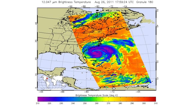
Infrared image of Hurricane Irene taken at 1:59 p.m. EDT (17:59 UTC) on Aug. 26, 2011 by the Atmospheric Infrared Sounder (AIRS) instrument on NASA’s Aqua spacecraft. Areas colored purple represent the storm’s coldest cloud-top temperatures and areas of heaviest precipitation.
Large and powerful Hurricane Irene is poised to become the first hurricane to make landfall in the United States since Ike in 2008. As of Friday afternoon, Aug. Irene was a category two hurricane on the Saffir-Simpson hurricane wind scale, with maximum sustained winds near 100 mph (160 kilometers per hour). An initial landfall is predicted in eastern North Carolina on Aug. Beyond that, the storm is expected to skirt the coastline of the eastern United States. A second landfall is expected in New England on Aug. At that time, the storm is expected to be weaker but still dangerous.
TO READ THIS ARTICLE, CREATE YOUR ACCOUNT
And extend your reading, free of charge and with no commitment.