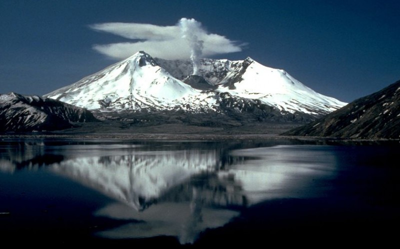
U.S. Geological Survey Mount St. Helens as it appeared two years after its catastrophic eruption on May 18, 1980.
Earth scientists are laying plans for a two-year study covering a broad area of southwestern Washington to develop a better understanding of how Mount St. Helens gets its supply of volcanic magma. "The main goal is to understand the plumbing system of the mountain,” said Kenneth Creager, a University of Washington professor of Earth and space sciences who is leading the study. The project, called Imaging Magma Under St. Helens , could bring improvements in volcanic monitoring and advance warning systems at Mount St. Helens and other volcanoes. The work will be within an area from Mount Rainier on the north to the Columbia River on the south, and from Interstate 5 on the west to Mount Adams on the east. It has three separate components: passive-source seismic monitoring, active-source seismic monitoring and magnetotelluric monitoring, which uses fluctuations in Earth's electromagnetic field to produce images of structures beneath the surface. Though the work will not be completed until the summer of 2016, most instruments will be deployed for substantially less time. Work planned inside Gifford Pinchot National Forest and Mount St. Helens National Volcanic Monument will not begin until after federal environmental permits are obtained.
TO READ THIS ARTICLE, CREATE YOUR ACCOUNT
And extend your reading, free of charge and with no commitment.