UW scientists track Sandy’s fury
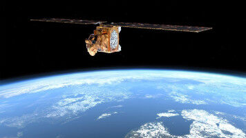
Hurricane Sandy has earned it reputation as a perfect storm, even among meteorologists. But while Louis Uccellini, environmental prediction chief for the National Oceanic and Atmospheric Administration , said, "This is the worst-case scenario," the storm researchers at the University of Wisconsin-Madison weren't so sure. Satellite images like this one of the Eastern Seaboard helped scientists at UW-Madison predict the course of Hurricane Sandy with remarkable accuracy. Courtesy of CIMSS "The worst case would be a bad prediction," said Chris Velden , senior researcher with the Madison-based Cooperative Institute for Meteorological Satellite Studies (CIMSS). Without an accurate idea of when and where the storm system will dump rain, push ocean water and bend trees, emergency planning would be little more than guesswork. "The models pegged this," Velden said. "We know who is in the way of the storm and what should happen when it arrives." Parked in front of banks of monitors Monday on the second floor of the Atmospheric, Oceanic and Space Science Building, Velden and about 20 scientists picked through storm plots and barometric pressure readings and water temperatures coming in from the National Hurricane Center and National Weather Service — including data fed to those agencies from satellites through Madison and CIMSS.